Capitol Reef National Park Map and Entrances Explained
Where Is Capitol Reef National Park?
Capitol Reef National Park is located in south-central Utah, United States. The park stretches for nearly 100 miles (160 km) along the spectacular Waterpocket Fold, a massive geologic wrinkle in the Earth’s crust that was formed millions of years ago.
The park is centered along Utah State Route 24 (UT-24), making it an easy stop on Utah’s famous Mighty 5 national parks road trip.
Capitol Reef National Park Location
- State: Utah
- Region: South-central Utah
- Nearest town: Torrey (about 11 miles west)
- Coordinates: 38.2917° N, 111.2615° W
- Time Zone: Mountain Time (MT)
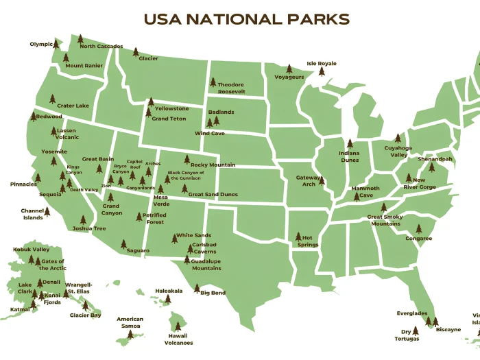
Capitol Reef National Park Map and Entrances
Click the image below to view map of Capitol Reef National Park in full size.
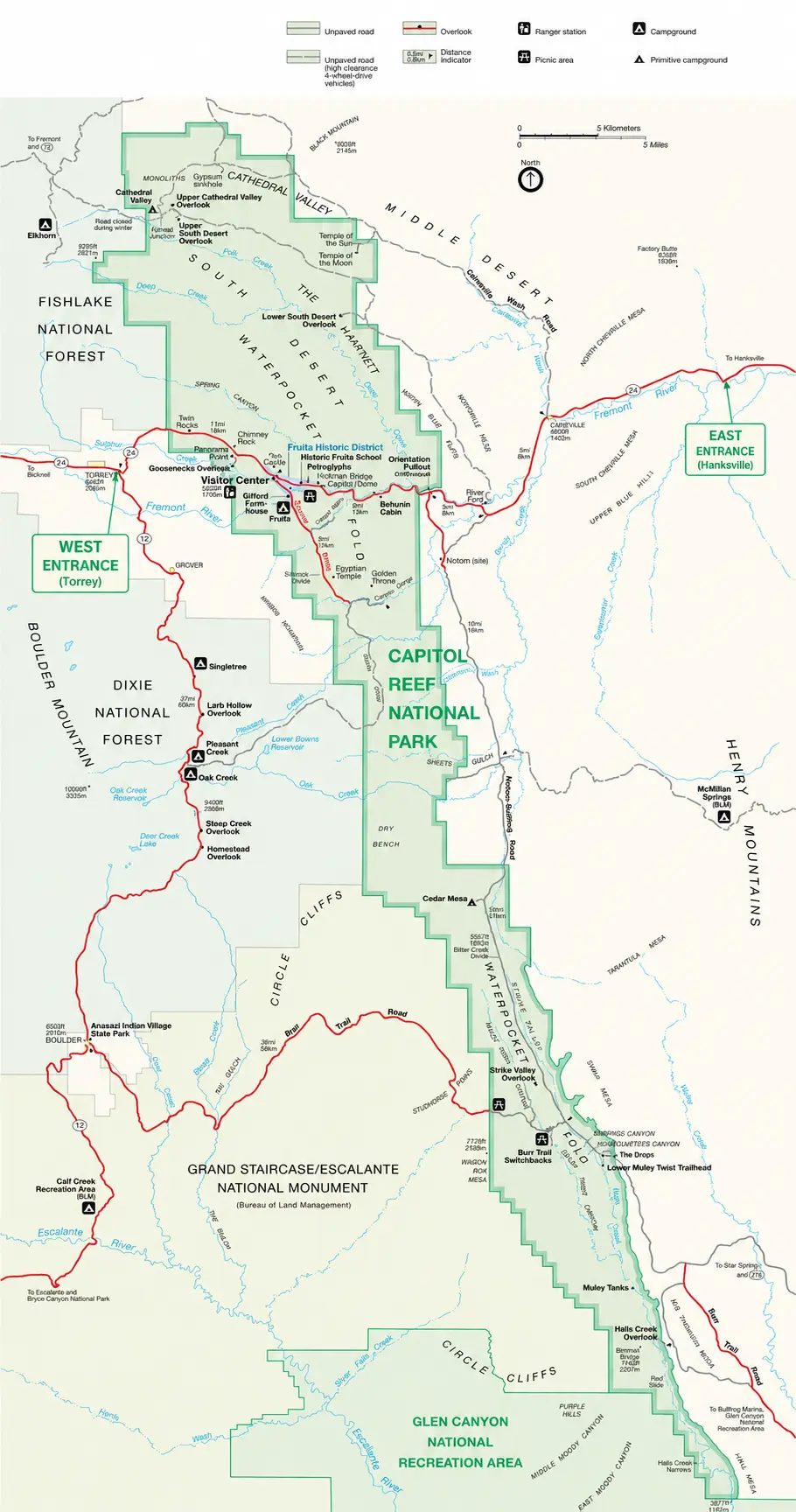
If you want to download Capitol Reef National Park map PDF file you click here
Capitol Reef National Park Entrances
West Entrance (Torrey side)
- Located just east of the town of Torrey, Utah.
- The most common entrance for visitors arriving from:
- Bryce Canyon National Park
- Zion National Park
- Interstate 70 (via UT-24)
- Provides quick access to:
- Capitol Reef Visitor Center
- Fruita Historic District
- Scenic Drive
East Entrance (Hanksville side)
- Located west of Hanksville, Utah along UT-24.
- Popular for visitors driving from:
- Moab
- Arches National Park
- Canyonlands National Park
- Goblin Valley State Park
- Passes through colorful sandstone cliffs, domes, and the Waterpocket Fold before reaching the central park area.
Visitor Center
The Capitol Reef Visitor Center is located along UT-24 near the Fruita Historic District, between the east and west approaches. It’s the best place to:
- Pick up maps
- Get current road conditions
- Purchase an entrance pass (or show a digital pass)
- Speak with park rangers
Important things to know
- There are no entrance gates on UT-24.
- The park is open 24 hours a day, year-round.
- An entrance fee is required for visiting the Scenic Drive and certain developed areas, even though you can drive through UT-24 without passing a gate.
For most visitors, the west entrance via Torrey is the preferred starting point because it’s closest to the Visitor Center, Fruita orchards, campground, and many of the park’s most popular hikes.
Distance from Nearby Cities
| City | Distance | Driving Time |
|---|---|---|
| Torrey, UT | 11 miles | 15 minutes |
| Hanksville, UT | 37 miles | 40 minutes |
| Richfield, UT | 78 miles | 1.5 hours |
| Moab, UT | 150 miles | 2.5–3 hours |
| Bryce Canyon National Park | 125 miles | 2.5 hours |
| Salt Lake City | 220 miles | 3.5–4 hours |
| Las Vegas, NV | 330 miles | 5.5–6 hours |
How to Get There
Most visitors enter the park via the west entrance near the town of Torrey on UT-24. The park’s main attractions—including the Visitor Center, Fruita Historic District, Scenic Drive, and many popular hiking trails—are all located along this highway.
If you’re exploring the park’s more remote areas, such as Cathedral Valley or the Waterpocket District, you’ll access them via backcountry roads from different directions. These routes often require high-clearance or four-wheel-drive vehicles.
Which National Parks Are Nearby?
Capitol Reef is part of Utah’s renowned Mighty 5 national parks and is conveniently located between several of them:
- Arches National Park – about 150 miles east
- Canyonlands National Park – about 160 miles east
- Bryce Canyon National Park – about 125 miles southwest
- Zion National Park – about 190 miles southwest
Many travelers include Capitol Reef on a week-long Utah road trip that visits all five parks.
Why Is It Called Capitol Reef?
The park gets its name from two distinctive landscape features:
- “Capitol” refers to the white Navajo Sandstone domes that resemble the dome of the U.S. Capitol building.
- “Reef” describes the Waterpocket Fold, which early explorers considered a rugged barrier to travel, much like an ocean reef.
Unlike many U.S. national parks, Capitol Reef National Park does not have formal entrance gates or multiple staffed entrance stations. Instead, visitors access the park via Utah State Route 24 (UT-24), which runs directly through the heart of the park.